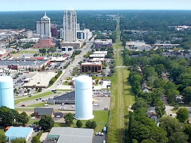
Virginia Beach Trail
The Virginia Beach Trail (#VBTrail) will be a 12-mile-long, 14-foot-wide, paved, shared-use path spanning our city from the Norfolk border at the Newtown Road HRT hub to Town Center all the way to the Oceanfront.
All Virginia Beach community recreation centers, parks and park facilities will be open to the public on Monday, Feb. 16. However, all City of Virginia Beach administrative offices will be closed in observance of George Washington Day.
Learn MoreLearn & earn this summer! Summer Youth Employment Applications are officially open.
Apply Now!
The Virginia Beach Trail (#VBTrail) will be a 12-mile-long, 14-foot-wide, paved, shared-use path spanning our city from the Norfolk border at the Newtown Road HRT hub to Town Center all the way to the Oceanfront.
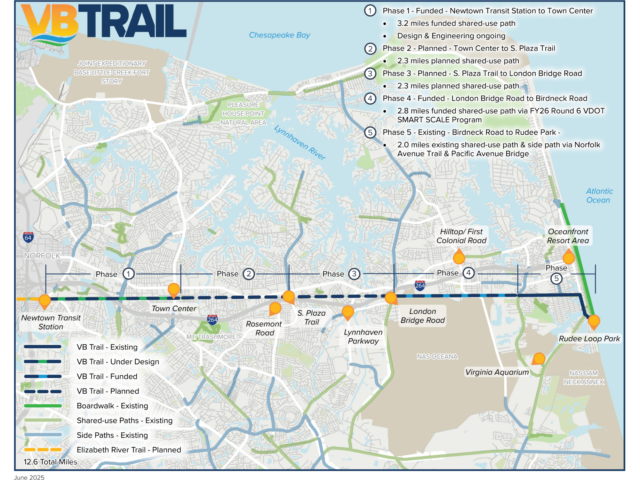
This funding of Phase 4 of the VB Trail project will provide a 2.8-mile section of a 14-foot-wide paved shared-use path that will extend the eastern portion of the trail from S. Birdneck Road to London Bridge Road, following the former Norfolk Southern railroad alignment owned by the City of Virginia Beach. The VB Trail has been in the City of Virginia Beach plans since 1981, and assembling this funding is a great step forward to promote equitable access to a more complete active transportation network, increase pedestrian and bicycle user safety, and spur economic strength and vitality.
This new funding builds upon the success of December 2023, when the city secured $14.9 million from the U.S. Department of Transportation's Safe Streets and Roads for All Grant Program for Phase 1 of the VB Trail. Phase 1 is a 3.2-mile, 14-foot-wide paved shared-use path connecting the city's western border with Norfolk at Newtown Road to Constitution Drive in Virginia Beach Town Center. This segment notably includes an ADA-compliant pedestrian/bicyclist bridge over the 10-lane Independence Boulevard and is currently in the design phase.
The easternmost 1.5 miles of the VB Trail already exist along Norfolk Avenue at the oceanfront Resort Area, near Rudee Loop. When the VB Trail is completed its 12 miles of shared-use path will cross the full width of the City of Virginia Beach, connecting communities, key destinations, and other pathways. The VB Trail is also an important part of the City's long-term Comprehensive Plan Update now underway. The VB Trail will also be the easternmost segment of the 41-mile-long South Hampton Roads Trail and larger systems across the region, state, and nation.
The VB Trail is the top priority in the City’s Active Transportation Plan and will advance safety for both bicycle and pedestrian users, as well as vehicular modes of travel.
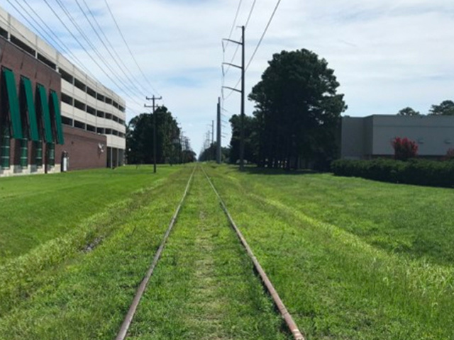
The Virginia Beach Trail (#VBTrail) will be a 12-mile-long, 14-foot-wide, paved shared-use path spanning our city from the Norfolk border at the Newtown Road HRT hub to Town Center all the way to the Oceanfront. It will occupy a narrow strip of the 66-foot-wide City-owned former Norfolk Southern railroad right-of-way, leaving room for other public purposes.
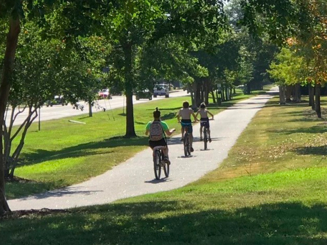
The easternmost 1.5 miles of the trail are already constructed in the Resort Area, on the north side of Norfolk Avenue between Birdneck Road and Pacific Avenue. The remaining 10.5 miles have been designed to 15% construction drawings. The Trail will serve pedestrians, bicyclists, wheelchair users, strollers, runners, workers, students, families, and tourists by providing a safe, non-vehicular travel corridor across Virginia Beach.
This project will link other active transportation routes into a network, increasing the value of existing pathways by connecting more neighborhoods with more destinations.
The City of Virginia Beach is seeking funding to design and construct the remaining seven miles of the Virginia Beach Trail.

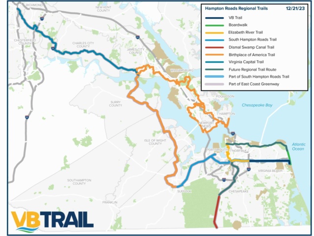
The trail is the easternmost segment of the regional South Hampton Roads Trail, a proposed regional trail that runs through Suffolk, Portsmouth, Norfolk, and Chesapeake. The Trail will provide equitable access to a regional active transportation network, increase pedestrian and bicycle user safety, and spur economic strength and vitality.
It is the final segment of the Regional Trail System that will connect Richmond to the Virginia Beach Oceanfront, giving it regional and statewide reach and significance. The Trail will also be part of Virginia's Beaches to Bluegrass Trail.
The trail has been a part of the City Council-adopted Virginia Beach Active Transportation Plan since 1981 and has continued to be a priority project. Continuation of the design and construction of the project is pending future funding. Bikeways and trails have topped Virginia Beach resident surveys of the most important and needed public recreational amenities because they benefit people of all abilities and all walks of life.
The Hampton Roads Transportation Planning Organization has ranked the Trail as a top regional priority, and it is part of strategies for recreational tourism, workforce recruiting and retention, and economic development.
